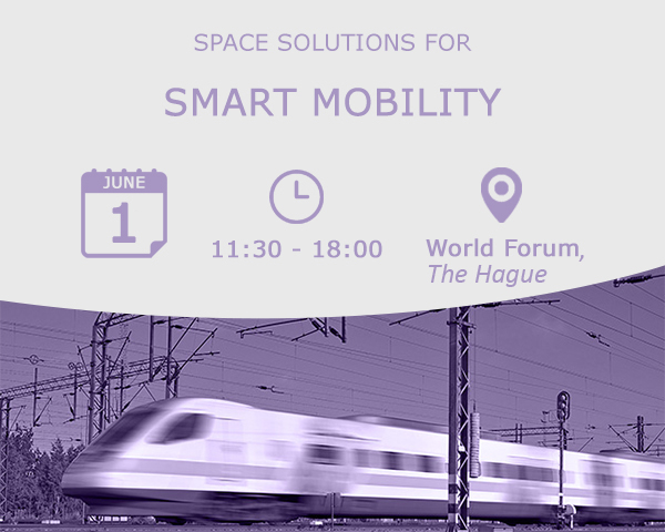
On 1 June, the 2016 European Space Solutions event features a 1-day workshop on how the road and traffic management sectors can benefit from European satellite navigation and Earth observation information.
Space and satellite navigation are key enablers for the delivery of the next generation of mobility – and European Global Navigation Satellite Systems (GNSS) offers the precision, robustness and reliability needed for autonomous and connected vehicles, fleet management and payment-related applications.
In fact, navigation is one of the most common ways that GNSS programmes such as Galileo, the European Geostationary Navigation Overlay Service (EGNOS) and Copernicus can be used in smart mobility applications. For example, satellites help provide turn-by-turn information to drivers, cyclists and even pedestrians. They can be used in fleet management on-board units and road traffic monitoring services. GNSS also plays a critical role in providing smart emergency services, with Europe’s eCall system using GNSS to automatically communicate a vehicle’s exact location to emergency services whenever an accident occurs.
Also read: GNSS applications in the road sector
Furthermore, the positioning data provided by liability applications are linked to legal and economic liabilities, including Road User Charging (RUC) and insurance telematics. Thanks to its flexibility, satellite navigation has become the preferred solution for electronic tolling, with countries like Germany, Slovakia, Switzerland and Hungary having already successfully implemented GNSS-based tolling schemes.
An array of applications
Many companies and projects are already developing GNSS-based applications to serve the growing demands for smart mobility solutions. For instance, the Horizon 2020-funded Saturn project has demonstrated how the open basis availability of Earth observation (EO) data, combined with public or crowd-sourced GNSS-based transport data, can help urban and regional authorities implement more efficient transportation and urban planning. Also in the public transport domain, Kordis JMK, the operator of public transport in the South Moravian Region of the Czech Republic, uses GNSS surveillance to guarantee passenger connections for those changing between different modes of transport. Other innovative examples come from entrepreneurs like Geoimagine, whose network optimiser solution for fleet management uses mobile sensors to optimise itineraries to drive taxis towards areas with a higher potential number of clients depending on the time of day.
As a relatively new phenomenon, autonomous and connected vehicles are positioning themselves as the way of the future. Major vehicle manufactures are already delivering autonomous cars with such connected driver services as weather reports, and accident and traffic warnings. As the sophistication of these applications increases, GNSS will play a substantial role in providing accurate information for these vehicles. For example, Galileo is set to provide an even stronger service that is more resistant to multipath interference in urban canyons and will provide an authenticated signal capable of detecting spoofing attacks.
Ample opportunities
With growing cities and increased public transport, it is clear that GNSS services will become more and more important, and applications such as these are looking to secure a share of the massive GNSS global market. According to the latest edition of the GSA GNSS market report, GNSS receivers and services will have an estimated core revenue of EUR 36 billion by 2018, showing that EGNOS and Galileo-related road applications are in demand and will assist in optimising mobility for years to come.
A significant share of this market involves GNSS applications and services addressing issues relating to smart mobility – thus presenting a huge opportunity for European businesses, small and medium-sized enterprises (SMEs) and entrepreneurs. To help European industry better understand – and access – this lucrative market, the European Commission and the European GNSS Agency (GSA), under the auspices of the Dutch Council Presidency, are organising a special session on GNSS and smart mobility as part of the European Space Solutions Conference.
Register today!
The Smart Mobility Focus Session will address a wide range of applications for road and traffic management companies, including liability-critical applications, public transportation, smart cities and the driverless car. The session will highlight both state-of-the-art solutions and innovation, where the latest research and development (R&D) will demonstrate exciting ways in which space applications can influence the next generation of transport systems.
Users from both the public and private domains will be present, including speakers from the European Commission, national transportation agencies, the GSA, and a range of various research institutions and related businesses, including Fiat automaker. The all-day workshop will take place on 1 June 2016 as part of the European Space Solutions Conference in The Hague, The Netherlands. To ensure your business doesn’t miss out on this unique opportunity to get first-hand insights into how space offers real solutions to road and traffic management, secure your place by registering today.
Media note: This feature can be republished without charge provided the European GNSS Agency (GSA) is acknowledged as the source at the top or the bottom of the story. You must request permission before you use any of the photographs on the site. If you republish, we would be grateful if you could link back to the GSA website (http://www.gsa.europa.eu).